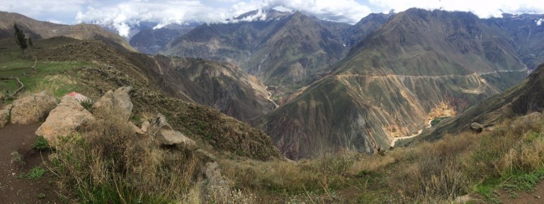

Colca Canyon’s claim to fame is both its depth- twice as deep as the Grand Canyon- and its condors, which you can see soaring closely to lookouts along the canyon’s rim. With the help of a few other informative bloggers (mainly, TheParallelLife and WhereIsYourToothbrush), I was excited to undertake this one unguided and on my own. After some scrutinous reading and re-reading of others’ blogs, I mapped out my path for the next few days.
Colca Canyon is just outside of the town Cabanaconde, and the only way there is a 6 hour bus ride from Arequipa…which is roughly an 8 hour bus ride from Cusco and Machu Picchu. So, needless to say, it was a journey. Arequipa is nice, sizable city with some great culinary options and museums; I spent just a day there before continuing on to Cabanaconde. I planned to spend a night in Cabanaconde, head to Llahuar first (with hot springs!) and then onto Sangalle/The Oasis for a night, and then hike up in the morning in time to catch the bus back to Arequipa. I also planned on checking out Mirador de Condor, a famous lookout where visitors can see condors up close and personal. If a decent map of the place existed, I’d draw it out for you, but the lack thereof was one of the more frustrating points of this hike. More on that later though.
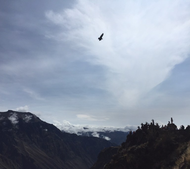

Initially, I was both proud and excited to find a local (read; cheap) bus that would take me up to the Mirador de Condor at 6am, in plenty of time to see the condors at their best at 8am. I not only beat all the other tourists…but also the local vendors. An hour and half later, I’d had more than my fill of bird-watching. Only then did I figure out that hitching a ride back to town with a tourist bus was damn near impossible, and the next local bus wouldn’t be back until 9:00am. Two and a half hours is a long time to look at birds, even if they are majestic, large condors. I’ve got a lot of mediocre iPhone pictures of condors now, if anyone needs one.
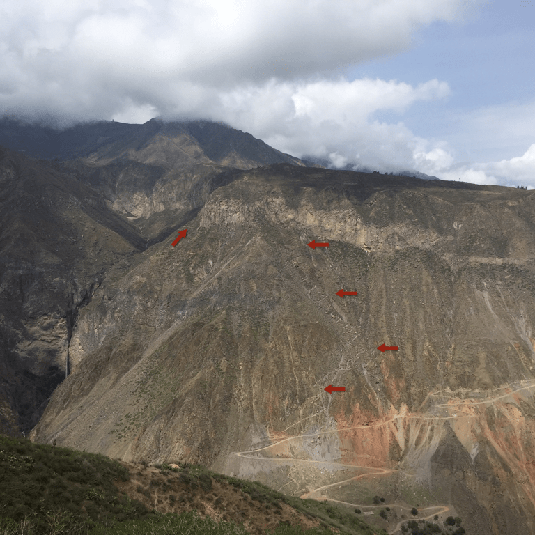
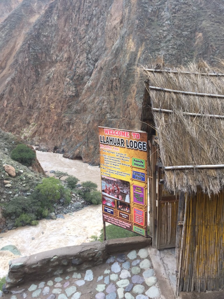
After arriving back in town, I set out to Llahuar, one of several cabanas within Colca Canyon. From town, the directions were to “head down that street, and just keep going”. Other bloggers assured me that, even though you think you’re heading the wrong direction, you are going the right way. So, when I walked through what seemed like someones backyard and cautiously made my way past some horses to climb up a small ledge, I wasn’t phased. And, while I did get a little turned around initially, once I found the actual path it was a straightforward hike without any options to turn off or get lost. Which was good, because the maps I had were so bad, they were missing major landmarks- like large creeks, bridges, and even a geyser. Trail markings were sparse as well; in a six hour hike, there were no other hikers, just two signs and then two locals along the path to guide me.

Path down to Llahuar that I took the first day, as viewed from the other side of the canyon on my second days hike.
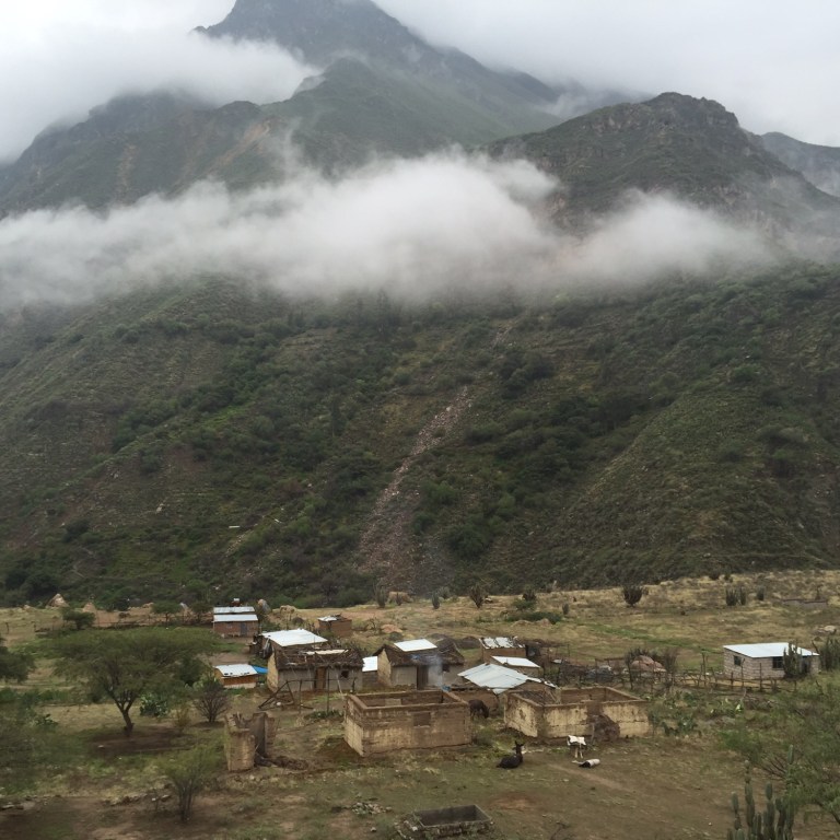
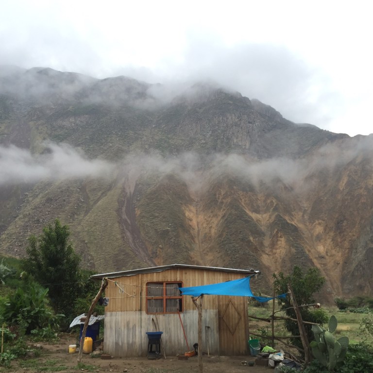
Nevertheless, I found Llahuar without incident. And, even though the hot springs was closed due to the heavy rainfall, the place was awesome. It was cheap, the beds were comfortable, they had flush toilets, showers (cold showers, but hey, in the middle of a canyon you can’t be picky!), hot meals, and some great little pisco sours. All these modern day facilities, combined with a couple of other fun guests made for a great nights stay.

The next day, the lack of a good map turned out to be a much bigger deal. While my map made it appear that I’d be hiking along the river to the next cabana, I actually needed to hike to almost the rim of the canyon and along a path, and then back down to get to Sangalle. I also missed a landmark called “terminal bus” because its really just two roads that intersect, with no signs or markings. Its also much easier to convince yourself that you’re going the right direction when you are heading downhill, so I didn’t realize my mistake until I got down to the river and found that the path ended there. In the end, I only lost an hour, but it was a begrudging hike back up toward Llahuar, and then again up further towards the rim before hiking back down to the bottom to Sangalle. I did some more hiking through what seemed like folks’ backyards (there are several small villages in the canyon) and was able to ask for directions. Additionally, and luckily, there was a mother and daughter hiking the same path that had hired a guide, and when I ran into them on my hike back up I shamelessly asked questions/followed them until I was certain of my direction.


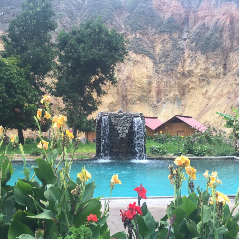
Sangalle was also well worth the hike. There are four cabanas there, and each one has their own pool, bar, and accommodations for sleeping and eating. I again scored my own room for cheap, a mojito while relaxing by the pool, and a hot meal specially prepared for me with rice instead of pasta. Not too shabby for “roughing it”. 🙂
From Sangalle up to Cabanaconde is a straightforward but steep 3 hour hike to the rim. My snoozing made me miss the 9am bus but gave me time for some coffee and a shower before the 11:30 back to Arequipa.
From Arequipa, I’d continue on to Nazca (Nazca lines!), Ica (pisco!), and then Lima. I try not to let on as to how far behind I’m running on blogging, but for a quick update-as of a few weeks ago I’m back stateside, enjoyed a small dose of SXSW and a larger one of March Madness, and am currently in Denver and heading to Utah for some camping and hiking there!